Remote Sensing and Image Processing for Biodiversity Conservation
Remote Sensing is a powerful technology used in Biodiversity Conservation that involves collecting information about an object or area from a distance, typically from aircraft or satellites. This technology plays a crucial role in monitorin…
Remote Sensing is a powerful technology used in Biodiversity Conservation that involves collecting information about an object or area from a distance, typically from aircraft or satellites. This technology plays a crucial role in monitoring, managing, and conserving biodiversity by providing valuable data on various aspects of the environment.
Image Processing is the analysis and manipulation of images to extract meaningful information. In the context of biodiversity conservation, image processing techniques are used to analyze remotely sensed data and extract vital information about ecosystems, species distribution, habitat quality, and other relevant parameters.
Artificial Intelligence (AI) refers to the simulation of human intelligence processes by machines, especially computer systems. In the context of biodiversity conservation, AI techniques are used to analyze large datasets generated through remote sensing and image processing to extract valuable insights for better decision-making and conservation efforts.
Biodiversity refers to the variety and variability of life forms on Earth, including species diversity, genetic diversity, and ecosystem diversity. Biodiversity is essential for the functioning of ecosystems, providing numerous ecosystem services that are crucial for human well-being.
Conservation is the management and protection of natural resources to ensure their sustainable use for future generations. Biodiversity conservation aims to protect and preserve the variety of life forms on Earth to maintain ecological balance and ensure the well-being of all living organisms.
Spatial Resolution refers to the level of detail that can be observed in an image or dataset. Higher spatial resolution means that smaller objects or features can be distinguished, while lower spatial resolution provides a broader view of the area. Spatial resolution is a critical factor in remote sensing for biodiversity conservation as it determines the level of detail that can be captured and analyzed.
Spectral Resolution refers to the ability of a sensor to distinguish between different wavelengths of light. Different materials reflect and absorb light in unique ways, allowing for the differentiation of various land cover types, vegetation species, and other features. Spectral resolution is essential for identifying and mapping different components of ecosystems in remote sensing data.
Temporal Resolution is the frequency at which data is collected over a specific area or time period. Higher temporal resolution means that data is collected more frequently, allowing for the monitoring of changes over time. Temporal resolution is crucial for tracking seasonal variations, ecosystem dynamics, and biodiversity trends in remote sensing applications.
Multi-spectral Imaging involves capturing images at multiple wavelengths of light, typically in specific bands such as red, green, and blue. Multi-spectral data provides valuable information about land cover, vegetation health, and other environmental parameters by analyzing the unique spectral signatures of different features. This technique is widely used in remote sensing for biodiversity conservation to identify and monitor various components of ecosystems.
Hyperspectral Imaging involves capturing images at numerous narrow and contiguous spectral bands across the electromagnetic spectrum. Hyperspectral data provides detailed information about the chemical composition, structure, and health of vegetation, allowing for precise identification of plant species, stress detection, and habitat mapping. Hyperspectral imaging is valuable for biodiversity conservation as it enables in-depth analysis of ecosystem components and processes.
LiDAR (Light Detection and Ranging) is a remote sensing technology that uses laser pulses to measure distances to objects and surfaces on the Earth's surface. LiDAR data provides detailed 3D information about terrain, vegetation structure, and land cover, allowing for accurate mapping of habitats, canopy heights, and topographic features. LiDAR is widely used in biodiversity conservation for habitat modeling, species distribution mapping, and ecosystem monitoring.
Object-Based Image Analysis (OBIA) is an image processing technique that focuses on grouping pixels into meaningful objects or segments based on their spectral, spatial, and contextual characteristics. OBIA allows for the extraction of information at the object level, enabling more accurate classification and analysis of remote sensing data. This approach is beneficial for biodiversity conservation as it helps in identifying and delineating specific features of interest, such as habitats, species distributions, and landscape elements.
Machine Learning is a subset of artificial intelligence that enables computers to learn from data and make predictions or decisions without being explicitly programmed. Machine learning algorithms are used in remote sensing and image processing for biodiversity conservation to classify land cover, detect changes, and analyze patterns in large datasets. These algorithms can improve the efficiency and accuracy of data analysis, leading to better conservation outcomes.
Deep Learning is a type of machine learning that uses artificial neural networks to model and process complex data. Deep learning algorithms, such as convolutional neural networks (CNNs) and recurrent neural networks (RNNs), are increasingly used in remote sensing and image processing for biodiversity conservation to extract features, classify images, and predict ecological patterns. Deep learning techniques can handle large and high-dimensional datasets, making them valuable tools for analyzing remote sensing data for conservation purposes.
Feature Extraction is the process of identifying and quantifying relevant information from raw data. In remote sensing and image processing, feature extraction involves identifying key characteristics or patterns in images or datasets that are essential for classification, analysis, and interpretation. This process is crucial for biodiversity conservation as it helps in extracting meaningful information from remote sensing data to understand and monitor ecosystems effectively.
Classification is the process of categorizing pixels or objects in an image into different classes or categories based on their spectral, spatial, or temporal properties. Classification techniques are used in remote sensing for biodiversity conservation to map land cover, vegetation types, habitat classes, and other ecological features. Accurate classification is essential for monitoring biodiversity trends, assessing habitat quality, and planning conservation interventions.
Change Detection is the process of identifying and analyzing differences between images or datasets acquired at different times. Change detection techniques are used in remote sensing and image processing for biodiversity conservation to monitor land cover changes, deforestation, habitat loss, and other environmental transformations. Detecting changes over time is critical for understanding ecosystem dynamics, assessing conservation impacts, and prioritizing conservation actions.
Species Distribution Modeling (SDM) is a technique used to predict the potential distribution of species based on environmental variables and species occurrence data. SDM combines species occurrence records with environmental data, such as climate, topography, and land cover, to model the habitat suitability of species across landscapes. This approach is valuable for biodiversity conservation as it helps in identifying species-rich areas, predicting species distributions under different scenarios, and prioritizing conservation efforts.
Habitat Mapping involves delineating and characterizing different habitat types within an ecosystem based on their biophysical and ecological characteristics. Habitat mapping techniques use remote sensing data, such as satellite imagery, LiDAR, and aerial photography, to identify and map habitat features, such as forests, wetlands, grasslands, and water bodies. Habitat mapping is crucial for biodiversity conservation as it provides essential information for habitat assessment, species monitoring, and conservation planning.
Ecological Modeling is the process of simulating and predicting ecological processes, interactions, and patterns using mathematical and computational models. Ecological models are used in biodiversity conservation to understand species dynamics, ecosystem functioning, and landscape processes. These models help in predicting the impacts of environmental changes, assessing conservation scenarios, and designing effective conservation strategies.
Remote Sensing Platforms are the vehicles or devices used to acquire remote sensing data from the Earth's surface or atmosphere. Common remote sensing platforms include satellites, aircraft, drones, and ground-based sensors. Each platform has unique capabilities, spatial resolutions, and spectral ranges, making them suitable for different applications in biodiversity conservation. Choosing the right remote sensing platform is essential for collecting accurate and relevant data for conservation purposes.
Satellite Remote Sensing involves collecting images and data of the Earth's surface using satellites orbiting the planet. Satellite remote sensing provides global coverage, frequent data acquisition, and multispectral or hyperspectral capabilities, making it a valuable tool for monitoring biodiversity at various spatial and temporal scales. Satellite data is widely used in biodiversity conservation for mapping land cover, monitoring habitats, and assessing ecosystem changes over large areas.
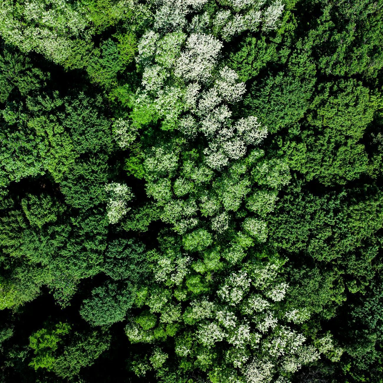
Aerial Remote Sensing involves capturing images and data of the Earth's surface from aircraft flying at different altitudes. Aerial remote sensing offers higher spatial resolutions and greater flexibility in data collection compared to satellite remote sensing, making it suitable for detailed mapping, monitoring, and analysis of biodiversity at regional or local scales. Aerial imagery is commonly used in biodiversity conservation for habitat mapping, species monitoring, and ecosystem assessment.
Unmanned Aerial Vehicles (UAVs), also known as drones, are remotely piloted aircraft equipped with sensors for capturing images and data of the Earth's surface. UAVs provide high-resolution, real-time data collection capabilities for biodiversity conservation applications, such as habitat mapping, species monitoring, and environmental assessment. UAVs are cost-effective, flexible, and easy to deploy, making them valuable tools for capturing detailed information on ecosystems and species.
Challenges in Remote Sensing for Biodiversity Conservation include data availability, quality, and processing, as well as the complexity of ecosystems, species interactions, and conservation goals. Overcoming these challenges requires integrating multiple data sources, developing advanced analytical techniques, and collaborating with experts from various disciplines to address conservation issues effectively. Remote sensing technologies continue to evolve, offering new opportunities and solutions for biodiversity conservation in a rapidly changing world.
In conclusion, remote sensing and image processing play a vital role in biodiversity conservation by providing valuable data, insights, and tools for monitoring, managing, and protecting ecosystems and species. By leveraging advanced technologies such as artificial intelligence, machine learning, and deep learning, conservationists can analyze large and complex datasets to inform conservation decisions, prioritize actions, and achieve sustainable outcomes for biodiversity and the environment. The integration of remote sensing with ecological modeling, species distribution modeling, and habitat mapping enables conservation practitioners to better understand, assess, and conserve the rich diversity of life on Earth. As the field of remote sensing continues to advance, it offers new opportunities and solutions for addressing the challenges of biodiversity conservation and ensuring the long-term health and resilience of ecosystems worldwide.
Key takeaways
- Remote Sensing is a powerful technology used in Biodiversity Conservation that involves collecting information about an object or area from a distance, typically from aircraft or satellites.
- In the context of biodiversity conservation, image processing techniques are used to analyze remotely sensed data and extract vital information about ecosystems, species distribution, habitat quality, and other relevant parameters.
- In the context of biodiversity conservation, AI techniques are used to analyze large datasets generated through remote sensing and image processing to extract valuable insights for better decision-making and conservation efforts.
- Biodiversity refers to the variety and variability of life forms on Earth, including species diversity, genetic diversity, and ecosystem diversity.
- Biodiversity conservation aims to protect and preserve the variety of life forms on Earth to maintain ecological balance and ensure the well-being of all living organisms.
- Spatial resolution is a critical factor in remote sensing for biodiversity conservation as it determines the level of detail that can be captured and analyzed.
- Different materials reflect and absorb light in unique ways, allowing for the differentiation of various land cover types, vegetation species, and other features.